Process Drone Images Into Maps Online
Upload up to 500 images and get high-resolution Orthophotos, Digital Surface Models (DSM), and 3D Point Clouds in under 60 minutes.
How Drone Image Processing Works
Experience a completely automated, end-to-end pipeline. From raw drone photos to advanced agricultural and construction analysis in minutes.
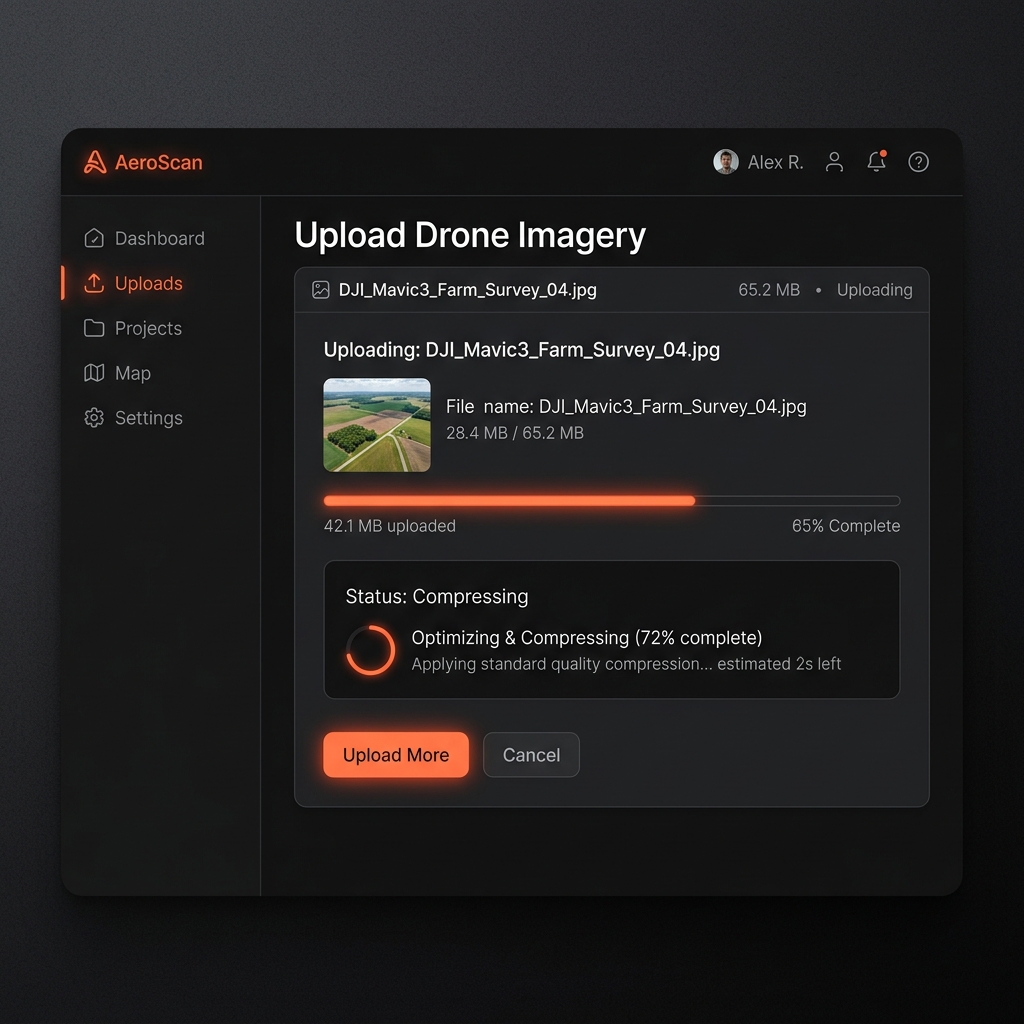
Fast Client-Side Compression & Upload
Our smart uploader compresses massive DJI and Autel JPEG images directly in your browser before uploading, without losing critical GPS EXIF metadata. This saves bandwidth and reduces transfer times by up to 80%.
- ✓ Preserves RTK / GPS Tags
- ✓ Dynamic Cost Estimation
- ✓ Resumes broken uploads
Serverless GPU Processing
Your images are securely dispatched to our scalable serverless compute cluster. We spin up dedicated RTX A6000 GPUs running our proprietary photogrammetry engine to crunch your dataset in parallel.
- ✓ Auto-splits massive datasets (5000+ images)
- ✓ Feature extraction & dense matching
- ✓ Real-time progress & log streaming

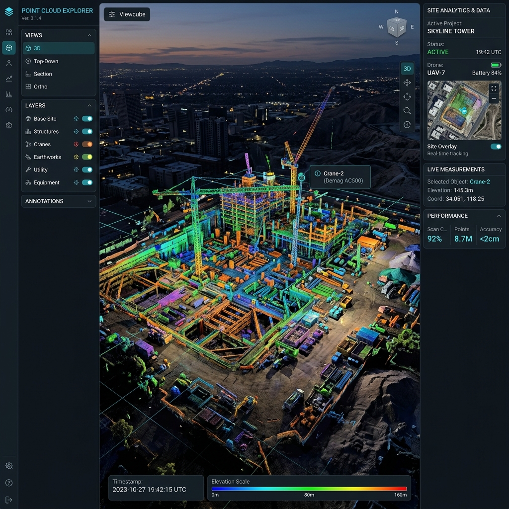
Interactive 2D & 3D Viewer
Don't just download files—explore them. Our built-in Potree and Leaflet engines let you instantly navigate your generated Orthophotos, 3D Point Clouds, and textured Meshes directly in the browser.
- ✓ High-res 2D map overlays
- ✓ Fluid 3D point cloud navigation
- ✓ Shareable secure viewer links
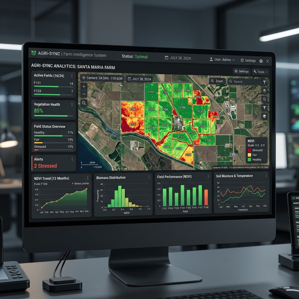
Advanced Industry Analysis
Unlock the true value of your maps. Run specialized agricultural and construction algorithms to generate heatmaps, calculate volumes, and monitor crop health with a single click.
- ✓ Agriculture: NDVI & VARI Plant Health Heatmaps
- ✓ Construction: Volumetric Measurements (Cut/Fill)
- ✓ Elevation Profiles & Distance Tracking
What You Get From Every Job
High-Res Orthophoto (.tif)
Distortion-free true map view, stitched perfectly. Accurate measurements guaranteed.
Elevation Models (.tif)
Detailed DSM/DTM height data used for contouring and volume calculations.
Point Cloud (.laz)
Millions of precise 3D points representing standard terrain topology.